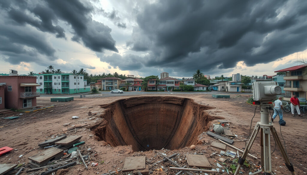
Phivolcs Aftershocks Cebu Earthquake – Latest Updates and Key Facts
A magnitude 6.9 earthquake struck offshore Northern Cebu on September 30, 2025, at 9:59 PM PST, triggering one of the most significant aftershock sequences recorded in the Philippines in recent years. The Philippines Institute of Volcanology and Seismology confirmed the mainshock originated at coordinates 11.10°N, 124.14°E, approximately 19 kilometers north 70° east of Bogo City, at a shallow depth of 5 kilometers.
By early November 2025, the seismic event had produced over 20,725 recorded aftershocks, according to PHIVOLCS monitoring data. The aftershock sequence has been linked to the activation of the Bogo Bay Fault, which satellite analysis confirmed had experienced surface rupture. While aftershocks continue at low magnitudes into early 2026, PHIVOLCS bulletins indicate no significant damage expectations from recent events.
Key Facts About the Cebu Earthquake Aftershocks
Critical Insights from PHIVOLCS Data
- The Bogo Bay Fault, previously dormant for approximately 400 years, produced surface rupture confirmed through satellite SAR analysis including DInSAR and pixel measurements
- Aftershocks peaked dramatically in the days following the mainshock, with 20,725 events recorded by November 4, 2025
- Current aftershock magnitudes range predominantly between 1.0 and 2.5, occurring at depths between 4 and 36 kilometers
- No tsunami bulletins were issued in connection with this seismic event
- PHIVOLCS issued a final aftershock bulletin on November 7, 2025, stating no expected damage or further significant aftershocks
- Recent activity as of late February 2026 remains concentrated near Bogo City, Borbon, and Medellin in Northern Cebu
- Ongoing monitoring continues through real-time bulletins on the PHIVOLCS earthquake monitoring portal
Aftershock Event Snapshot
| Date-Time (2026) | Magnitude | Depth (km) | Location |
|---|---|---|---|
| Feb 25, 6:17 PM | 2.3 | 36 | 22 km S 73° E of Borbon (Cebu) |
| Feb 25, 3:54 AM | 1.9 | 33 | 20 km N 32° E of City of Bogo (Cebu) |
| Feb 25, 3:45 AM | 2.5 | 8 | 23 km N 64° E of City of Bogo (Cebu) |
| Feb 23, 10:09 AM | 2.1 | 4 | 23 km N 75° E of City of Bogo (Cebu) |
| Feb 22, 5:08 PM | 1.7 | 31 | 12 km S 72° E of Medellin (Cebu) |
| Feb 21, 3:43 AM | 2.4 | 6 | 14 km S 35° W of City of Bogo (Cebu) |
What the Aftershock Data Reveals About Seismic Activity
The aftershock sequence following the September 2025 Cebu earthquake represents a typical stress redistribution pattern along the activated Bogo Bay Fault system. PHIVOLCS monitoring indicates that the vast majority of recorded aftershocks have remained below magnitude 3.0, with the highest recent reading reaching 2.5 on February 25, 2026. This gradual decline in magnitude and frequency aligns with established seismic behavior models for fault systems experiencing significant stress release events.
Aftershock Frequency Patterns
The concentration of aftershocks near Bogo City and surrounding municipalities in Northern Cebu reflects the offshore epicenter of the mainshock. Data shows seismic activity occurring at varying depths, with some events detected at shallow depths of approximately 4 kilometers and others reaching 36 kilometers below the surface. This depth variation suggests complex fault geometry along the Bogo Bay Fault zone, according to PHIVOLCS analysis.
PHIVOLCS continues real-time monitoring through its dedicated earthquake portal at earthquake.phivolcs.dost.gov.ph. The agency released a comprehensive primer on October 1, 2025, detailing mainshock parameters, aftershock expectations, and fault information. A visual poster featuring the epicenter map and event summary has been published to support public understanding of the seismic sequence.
Depth Distribution Analysis
Analysis of recent aftershocks shows a diverse depth distribution across the Northern Cebu region. Events recorded in late February 2026 indicate depths ranging from 4 kilometers to 36 kilometers, suggesting the activated fault segment extends across multiple geological layers. PHIVOLCS determines these parameters using incoming seismic data from regional monitoring stations, with hypocenters calculated through established triangulation methods.
Fault Activation and Tectonic Context
The September 2025 earthquake activated the Bogo Bay Fault, a tectonic structure that had remained dormant for approximately 400 years prior to this event. PHIVOLCS officials confirmed the fault showed clear surface rupture indicators through satellite SAR analysis, specifically using Differential Interferometric Synthetic Aperture Radar and pixel analysis techniques. This activation marks a significant seismic event for the region, breaking an extended quiet period along this particular fault segment.
Understanding the Bogo Bay Fault System
The Bogo Bay Fault forms part of the broader Philippine Fault system, a major tectonic boundary traversing the archipelago. The offshore epicenter location in Northern Cebu places the seismic activity within a known seismically active zone characterized by complex interactions between the Philippine Sea Plate and the Sundaland Block. The shallow depth of the mainshock at 5 kilometers contributed to the strong shaking reported across the Visayas region and extending into parts of Luzon and Mindanao.
The Philippines experiences frequent seismic activity due to its position along the Pacific Ring of Fire. PHIVOLCS maintains comprehensive historical records of destructive earthquakes, though specific prior Cebu equivalents to the September 2025 event are not detailed in current available documentation. Residents are encouraged to consult the PHIVOLCS earthquake information portal for regional historical context and preparedness guidance.
Timeline of Major Seismic Events
The progression of seismic activity following the September 2025 earthquake follows a documented sequence available through PHIVOLCS bulletins and monitoring records. From the initial mainshock through the sustained aftershock period, the timeline demonstrates the typical decay pattern observed in significant seismic events.
- September 30, 2025, 9:59 PM PST — Magnitude 6.9 mainshock strikes offshore Northern Cebu at 5 km depth, 19 km N 70° E of Bogo City
- Early October 2025 — Intense aftershock sequence begins with numerous events detected by PHIVOLCS regional monitoring
- November 4, 2025, 8:00 AM — Aftershock count reaches 20,725 recorded events, prompting PHIVOLCS calls for continued vigilance
- November 7, 2025 — PHIVOLCS bulletin explicitly states no expected damage or further aftershocks, marking formal end of active bulletins
- October 1, 2025 — PHIVOLCS releases comprehensive primer with mainshock parameters, aftershock expectations, and fault information
- February 2026 — Low-magnitude aftershocks (1.0–2.5) continue near Bogo City, Borbon, and Medellin
Confirmed Information Versus Outstanding Questions
| Established Facts | Remaining Uncertainties |
|---|---|
| Mainshock magnitude of 6.9 confirmed by PHIVOLCS | Precise extent of surface rupture along Bogo Bay Fault requires further satellite analysis |
| 20,725 aftershocks recorded by November 4, 2025 | Long-term seismic forecasting for the region beyond current monitoring data |
| Bogo Bay Fault activation confirmed, previously inactive ~400 years | Whether additional fault segments remain to be activated |
| November 7, 2025 bulletin states no expected damage from recent aftershocks | Intensity values for recent low-magnitude aftershocks not specified in bulletins |
| No tsunami bulletins were issued for this event | Whether data exists for events occurring after February 25, 2026 |
| Surface rupture confirmed through DInSAR and pixel analysis | Detailed geological mapping of fault geometry ongoing |
The Bogo Bay Fault in Regional Seismic Context
The activation of the Bogo Bay Fault represents a notable event in the seismic history of the Visayas region. Prior to September 2025, this particular fault segment had accumulated strain for approximately four centuries without producing significant earthquakes. The magnitude 6.9 mainshock released a substantial portion of this accumulated stress, though seismic systems typically require multiple events over time to fully redistribute tectonic forces along major fault structures.
The offshore location of the epicenter, combined with the shallow depth and substantial magnitude, resulted in strong shaking that residents across the Visayas, parts of Luzon, and portions of Mindanao reported feeling. This wide felt area reflects the earthquake’s significant energy release and the relatively efficient propagation of seismic waves through the Philippine archipelago’s geological structure.
The activation of the Bogo Bay Fault following approximately 400 years of inactivity represents a significant seismic event for Northern Cebu. Surface rupture has been confirmed through satellite SAR analysis, with data analysis continuing to refine our understanding of the fault geometry and potential implications for the region.
— PHIVOLCS official statement, October 2025
Summary of Current Seismic Status
The seismic situation in Northern Cebu following the September 30, 2025 magnitude 6.9 earthquake remains in a stable, declining phase. More than 20,000 aftershocks have been recorded since the mainshock, with activity now limited to low-magnitude events typically ranging between 1.0 and 2.5 in magnitude. PHIVOLCS monitoring continues through real-time bulletins, though no significant damage expectations or new warnings have been issued since the November 7, 2025 bulletin.
For those preparing for outdoor activities in seismic regions, having appropriate supplies can make a significant difference during emergency situations. Freeze Dried Meals NZ – Best Brands for Tramping offers guidance on selecting nutritious, long-lasting food options suitable for emergency preparedness kits and outdoor adventures alike.
Frequently Asked Questions
How many aftershocks has the Cebu earthquake produced?
PHIVOLCS recorded over 20,725 aftershocks by November 4, 2025. The sequence continues with low-magnitude events (mostly 1.0–2.5) detected into February 2026.
What is the current magnitude range of aftershocks?
Recent aftershocks recorded in late February 2026 range from magnitude 1.7 to 2.5, well below damaging levels.
Is Cebu safe from further damaging aftershocks?
The November 7, 2025 PHIVOLCS bulletin explicitly stated no expected damage or further aftershocks. Current activity consists of minor tremors requiring no additional warnings.
What fault caused the September 2025 earthquake?
The Bogo Bay Fault, previously dormant for approximately 400 years, produced the mainshock and subsequent aftershock sequence. Surface rupture has been confirmed through satellite analysis.
Were any tsunami warnings issued?
No tsunami bulletins were issued in connection with this seismic event, according to PHIVOLCS records.
How deep are the recent aftershocks occurring?
Recent aftershocks have been detected at depths ranging from 4 kilometers to 36 kilometers below the surface, indicating activity across multiple fault levels.
Where can I find real-time aftershock data?
PHIVOLCS provides real-time earthquake bulletins through earthquake.phivolcs.dost.gov.ph.
How long will aftershocks continue?
While the official aftershock bulletin concluded in November 2025, low-magnitude events continue into February 2026. Aftershock sequences can persist for months or years following significant earthquakes.
More related posts
 Westpac NZ Login Online Banking – Secure Step-by-Step Guide
 Hayley Sproull Partner Split: Latest on Aaron and More
 Portable Induction Cooktop NZ: Complete Buying Guide
 Interest Rates in NZ: Mortgage Rates, Forecast & Bank Offers 2026
 Station Hotel Tenancy Breaches: $240,700 Penalty & Tenant Rights
 Shangri-La Yanuca Island Fiji: Honest Resort Guide
 The Best Chocolate Chip Cookie Recipe – Easy, Soft & Chewy
 New Balance 574 Classic Review: Sizing, Comfort & Buy
