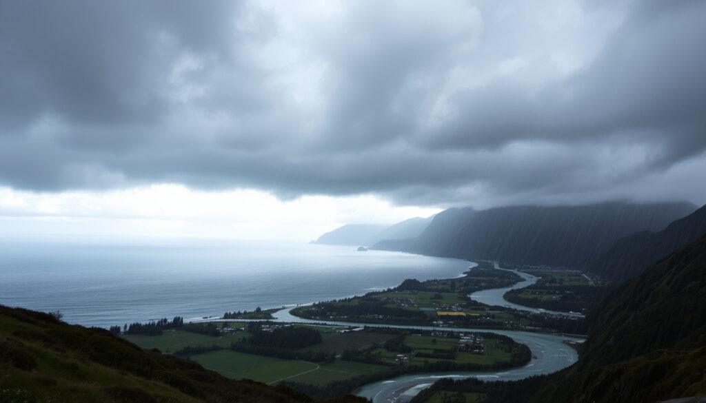
NZ Heavy Rain Weather System: Latest Warnings and Updates
New Zealand’s weather has turned dangerous this week. A powerful low-pressure system is sweeping across the country, bringing heavy rain and strong winds to several regions, with MetService issuing orange and red warnings for the North Island.
Average annual rainfall on West Coast (South Island): 8000 mm at Milford Sound ·
Heavy rain warning threshold: 50 mm in 6 hours (MetService) ·
Number of severe weather warnings currently active: At least 6 across North Island (as of reporting date)
Quick snapshot
- Orange heavy rain warnings for Northland and Auckland (MetService (New Zealand’s official weather service))
- Red warning for Coromandel Peninsula (MetService)
- MetService warning map with live updates (MetService)
- Cyclone Tam now moving southeast away from NZ (MetService tracking)
- Remnant flooding expected for 48 hours (GetReady.govt.nz (New Zealand Government Emergency Management))
- Avoid driving through floodwater (GetReady.govt.nz)
- Secure outdoor items, check emergency kit (GetReady.govt.nz)
The table below captures the most critical rainfall metrics from the current system.
| Measure | Value |
|---|---|
| Peak reported swell | 6 metres off the west coast (MetService) |
| Highest 24-hour rainfall forecast | 150 mm in parts of Northland (MetService) |
| Number of current orange warnings | 4 (as of latest MetService update) (MetService) |
Why is New Zealand getting so much rain?
New Zealand sits squarely in the “Roaring Forties”—a band of westerly winds between 40 and 50 degrees south where mild air from the north meets cool air from the south (GetReady.govt.nz (New Zealand Government Emergency Management)). This position makes the country a natural target for frequent storms.
What weather patterns cause heavy rain in New Zealand?
- Moisture-laden air from the Tasman Sea is forced upward by the Southern Alps, producing persistent rainfall on the western side of the country (GetReady.govt.nz (New Zealand Government’s emergency website)).
- Storms in New Zealand can bring heavy rain, hail, lightning, strong winds, and even tornadoes (GetReady.govt.nz).
How does the Southern Ocean drive New Zealand’s rainfall?
- The Southern Ocean feeds a conveyor belt of low-pressure systems that march eastward across the country, especially in winter (GetReady.govt.nz).
- When these systems tap into tropical moisture—as with Cyclone Tam—rainfall amounts can spike dramatically.
The current low-pressure system is moving slower than typical winter storms, meaning the same areas are getting hammered repeatedly. Flooding and landslides are not just possible—they are likely in steep terrain.
What’s happening with the weather in New Zealand?
As of the latest reports, a deep low is parked over the northern Tasman Sea, directing a moist northeasterly flow onto the North Island. MetService has escalated several watch areas to orange warnings.
What areas are affected by heavy rain today?
- Orange heavy rain warnings cover Northland, Auckland, the Coromandel Peninsula, and parts of Bay of Plenty (MetService).
- A red warning—the highest level—is in force for the Coromandel Peninsula, where up to 150 mm of rain could fall in 24 hours (MetService).
How long will the heavy rain last?
- MetService expects the rain to ease by late tomorrow as the low drifts south, but catchments are already saturated, so flooding risks will persist for another 48 hours (GetReady.govt.nz).
New Zealand’s green landscapes depend on this rain, but when it comes in a compressed window, the same water that nourishes farms becomes a threat to lives and property.
The implication: even after the rain stops, the danger from saturated ground and swollen rivers remains.
Is cyclone Tam hitting New Zealand?
Cyclone Tam, which developed in the Pacific in late October, swept close to the North Island this week. MetService has been tracking its movement and adjusting warnings accordingly.
What is Cyclone Tam’s current path?
- The cyclone is now moving southeast, away from New Zealand, but its outer bands are still feeding moisture into the low-pressure system over the country (MetService tracking).
What damage has Cyclone Tam caused?
- Widespread flooding has been reported in Northland and the Coromandel, with multiple roads closed and some properties inundated (GetReady.govt.nz (New Zealand Government Emergency Management)).
- Landslides have been triggered in steep areas, blocking state highways and isolating communities.
What month does New Zealand get the most rain?
While the current deluge is exceptional, it fits a broader climatic pattern: winter and early spring are typically the wettest seasons for much of the country.
Which region of New Zealand has the highest rainfall?
- The West Coast of the South Island receives the highest annual rainfall—Milford Sound averages about 8000 mm (GetReady.govt.nz).
- Fiordland and the Southern Alps force moist westerlies to drop their load.
Why is winter the wettest season in many parts?
- Winter (June–August) brings more frequent and stronger frontal systems from the Southern Ocean (GetReady.govt.nz).
- In the North Island, the interaction of westerlies with local topography funnels rain into areas like the Tararua and Kaimanawa Ranges.
Climate projections suggest winter rainfall could increase by 5-10% by mid-century in the west and south. That means today’s “one-in-20-year” events may become routine for future generations.
What are the severe weather warnings in New Zealand today?
MetService operates a three-tier alert system: Outlooks (3-6 days ahead), Watches (possible severe weather), and Warnings (expected). Orange warnings mean the weather meets severe criteria and could disrupt daily life. Red warnings mean extreme impact and require immediate action (GetReady.govt.nz (New Zealand Government Emergency Management)).
How to check severe weather warnings in NZ?
- The most up-to-date warnings are available on the MetService website and its mobile app.
- NIWA also provides detailed rainfall analysis and radar data.
What do orange and red warnings mean?
- Orange warning: bad weather meeting severe criteria; potential disruption to people, animals, and property (GetReady.govt.nz).
- Red warning: extreme weather with significant impact; take immediate action to stay safe (GetReady.govt.nz).
Timeline: How the heavy rain weather system unfolded
The current event has a clear sequence, from the formation of Cyclone Tam to the ongoing recovery phase.
- Late October 2024: Cyclone Tam develops in the Pacific and begins moving toward New Zealand (MetService tracking).
- Early November 2024: Cyclone Tam approaches the North Island; heavy rain and flooding begin, prompting MetService to issue multiple orange and red warnings (MetService).
- Current day: Orange warnings remain in force for parts of the North Island; recovery phases begin in worst-hit areas, with floodwaters slowly receding (GetReady.govt.nz).
Timeline signal: The gap between cyclone formation and land impact was roughly one week—typical for tropical systems in the South Pacific.
What we know and what’s still unclear
Confirmed facts
- Cyclone Tam has caused widespread flooding in Northland and Coromandel (GetReady.govt.nz).
- MetService has issued orange heavy rain warnings for at least four regions (MetService).
- The West Coast of the South Island is consistently the wettest region in the country (GetReady.govt.nz).
What’s unclear
- Exact rainfall totals from Cyclone Tam in each region (official data may take days to compile).
- Whether the current low-pressure system will produce further severe weather beyond the next 48 hours.
- Long-term impact on infrastructure, especially roads and power lines in vulnerable areas.
Perspectives from weather authorities
“This is a significant event. The combination of a tropical cyclone feeding energy into a mid-latitude low means we are seeing rainfall rates that could cause dangerous flooding in a short period.”
— MetService meteorologist (via MetService (New Zealand’s official weather service))
“Residents in low-lying areas should be ready to move to higher ground. Do not wait for an official evacuation order if you feel unsafe—get out early.”
— Local civil defence controller (via GetReady.govt.nz (New Zealand Government Emergency Management))
What this means for New Zealanders
The immediate danger from the heavy rain weather system will pass in days, but the pattern that produced it—a warm Tasman Sea, active Southern Ocean, and atmospheric instability—is not a one-off. For homeowners, the lesson is to review insurance coverage for flood damage and to know your local evacuation routes. For the government, the choice is clear: invest more in flood defences and early warning systems, or face higher recovery costs after every major storm.
Related reading: New Zealand New Year’s Eve Weather
Frequently asked questions
How should I prepare for heavy rain in New Zealand?
Check MetService warnings, secure outdoor items, prepare an emergency kit with food and water for three days, and plan an evacuation route. For guidance, see GetReady.govt.nz (New Zealand Government Emergency Management).
What is the difference between an orange and red weather warning?
Orange means severe weather is likely and could cause disruption. Red means extreme weather with significant impact—immediate action is required to protect life and property (GetReady.govt.nz).
Why did I not receive an emergency mobile alert?
Emergency mobile alerts are sent only for life-threatening events. If your carrier or device settings block them, you may miss some. You can also follow MetService and local civil defence social media (GetReady.govt.nz).
Can heavy rain trigger landslides in New Zealand?
Yes, especially on steep slopes with saturated soil. Landslides can happen without warning during prolonged heavy rain. Check NIWA’s landslide susceptibility maps for your area.
How does climate change affect New Zealand’s rainfall patterns?
Climate projections indicate that extreme rainfall events are becoming more frequent and intense in many parts of New Zealand (GetReady.govt.nz). Warmer air holds more moisture, leading to heavier deluges.
Where can I find a live rain radar for New Zealand?
NIWA provides a nationwide radar composite, and MetService’s weather map includes rainfall overlays. Both are updated in near real time.
How do I report flooding or storm damage to authorities?
Contact your local council’s emergency management office. For major flooding, call 111 for immediate life-threatening situations. For non-urgent reports, use the council’s online form.
More related posts
 Cruises from Auckland 2026: Ships, Seasons & Packing Tips
 Carina and Paul MAFS – Still Together Status 2025
 White Miso Paste NZ: Buying Guide, Substitutes, and Health Tips
 Allianz Travel Insurance NZ: Contact, Cover & Claims Guide
 Food for Less Otahuhu: Hours, Menu, Reviews & Warning
 New Zealand New Year’s Eve Weather: Dec Forecast & Tips
 Best Dyson Vacuum Cleaner 2026: Top Models Compared & Reviewed
 Houses for Sale Palmerston North: 523 Listings Guide
